Monday, 26 July 2021

WANDERLUST @ DELHI - VII : HIDDEN TREASURES OF MEHRAULI

Jahaz Mahal (in Urdu language ‘Jahaz’ means "Ship" and ‘Mahal’ means "Palace", the "Ship Palace"), is located next to Hauz-i-Shamsi in Mehrauli, Delhi on its northeastern corner. It was so named, since its reflection (illusion) in the surrounding reservoir looked like a ship floating on a lake. It is inferred to have been built during the Lodi dynasty period (1452–1526) as a pleasure resort, Sarai or an inn.


The monument is built in a robust style typical of the pre-Mughal period- of granite rubble. It is probably because of this it has with stood the ravages of time pretty well. Presently it is very poorly maintained- though i saw an ASI board there. The magnificently named Hauz-i-Shamshi ("Lake of Sunlight") is a huge cess pool with only sewage and hyacinth growing in it. The magnificent monument screams silently seeking attention and preservation!


Zafar Mahal, is the ruined summer palace of the last Mughal Emperor, Bahadur Shah Zafar II. 
Also known as Jangli Mahal, this structure is considered the last monumental structure built during the fading years of the Mughal era. The building has two components namely, the Mahal or the palace, which was built first by Akbar II in the 18th century, and the entrance gate that was reconstructed in the 19th century by Bahadur Shah Zafar II. The monument today is in a ruined state. Locals play cricket and gamble here. ASI had done a very little to preserve this monument

.


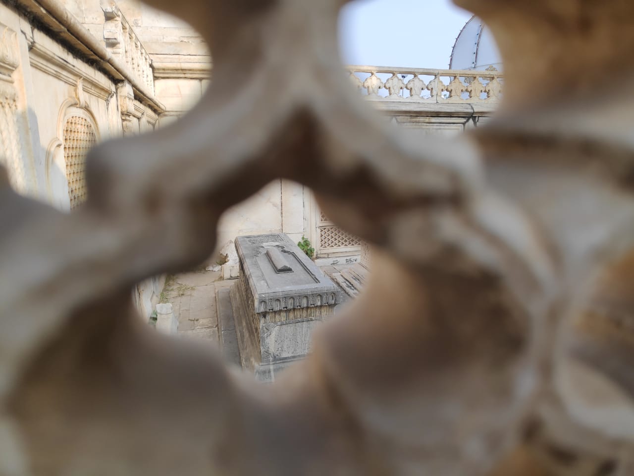
The graves in the precincts of Zafar Mahal, built within a marble screen enclosure by Jahandar Shah for his father Bahadur Shah I and others who followed, is a minor reflection of the history of the place. Shah Alam II who had the misfortune of being blinded by Ghulam Qadir, the Rohilla leader was buried here. He was considered a "puppet ruler", first under the Marathas and later under the British. His son Akbar II was also buried here. Mirza Fakruddin son of the last emperor Bahadur Shah Zafar, who died early ushered the end of the Moghul regime, was also buried here. But Bahadur Shah Zafar who had identified the location for his grave (sardgha – the vacant land for burial) was the most unfortunate (ill fated) as he was deported to Rangoon and was buried there.

 Adham Khan's Tomb is the 16th-century tomb of Adham Khan, a general of the Mughal Emperor Akbar. He was the younger son of Maham Anga, Akbar's wet nurse thus also his foster brother. However, when Adham Khan murdered Akbar’s favourite general Ataga Khan in May 1561, Akbar immediately ordered his execution by defenestration from the ramparts of the Agra Fort.


The tomb was built in 1562, and lies to the north of the Qutub Minar, Mehrauli, Delhi, immediately before one reaches the town of Mehrauli, it is now a protected monument by Archaeological Survey of India- but is in a very poor state of maintenance. The tomb is opposite Mehrauli bus terminus and many passengers use it as a place to wait.


The Masjid was built between 1351-54 by Khan-i-Jahan Junan Shah, the prime minister of Feroz Shah Tughlaq, the third ruler of the Tughlaq dynasty in Delhi. Feroz Shah is known for his keen interest in architecture, especially mosques, and his patronage of several building and conservation projects. In his autobiography Futuhat-i-Firozshahi, he writes, “Among the many gifts which God bestowed upon me, his humble servant, was a desire to erect public buildings. So, I built many mosques and colleges and monasteries”.


The Khirki Masjid, which happens to be one of seven mosques built by Junan Shah, exhibits some unique features and architectural achievements of its time. Most prominent among them is its covered square plan as opposed to the typical open courtyard congregational mosque, and the fusion of local elements such as “jali” style windows with mosque architecture.

Moreover, because of the constant threat of Mongol invasion, almost all structures of that period, including mosques, had a military character such as tapering walls and turrets surmounted by crenellated parapets. The result is a unique mosque that looks like a fortress, or qila.

This monument is well preserved and we were happy to find an alert security guard placed there by ASI to safeguard it.

Tuesday, 5 May 2020

SIKKIM DIARIES: MESMERIZING KUPUP


The village of Kupup is situated at an altitude of 13000 feet provides breathtaking views of the famous Elephant Lake, which got the name from its shape that resembles an elephant. Locally known as Bitan Choo, the lake is surrounded by towering snow clad mountains on one side and a difficult to maintain 15 feet wide road carpeted with fresh snow on the sides and in between that provides the only route to reach Kupup via the lake. Kupup has a helipad primarily for military use. 


Another point of attraction in Kupup is the Yak Golf Course which is considered to be the highest golf course in the world. Me and Samyukta had the privilege to play there (and they give you a certificate saying that you played in the higest golf course in the world after that!) The magnificent Tukla Valley opens up as one crosses Gnathang Valley and Old Baba Mandir which commemorates the valiant sacrifice of an Indian soldier Harbhanjan Singh who lost his life during the relief and rescue operation of people affected by terrible landslides and floods in this part of the region in the year 1968. There is an old war memorial too in Gnathang which commemorates Col Younghusband’s famous expedition to Tibet in the  early 20th Century.


A few houses dot the landscape on either side of this village as tyres wrapped in chains move in and out of this village with high degree of caution against possible slippage on the snow. There is another lake known as Menmecho lake, about 5 kms from Kupup and requires a possible diversion from the usual route that goes all the way to Nathula Pass.


WANDERLUST @ DELHI - VI : NATIONAL POLICE MEMORIAL


My last post was about the Mutiny Memorial. This article is about a memorial of a different kind- the National Police Memorial located in Chankyapuri, New Delhi- one of the latest additions to the already beautiful and rich architectural heritage of our amazing Capital City. (Location- https://goo.gl/maps/RkPbjEZ1nR7Fq7C29)


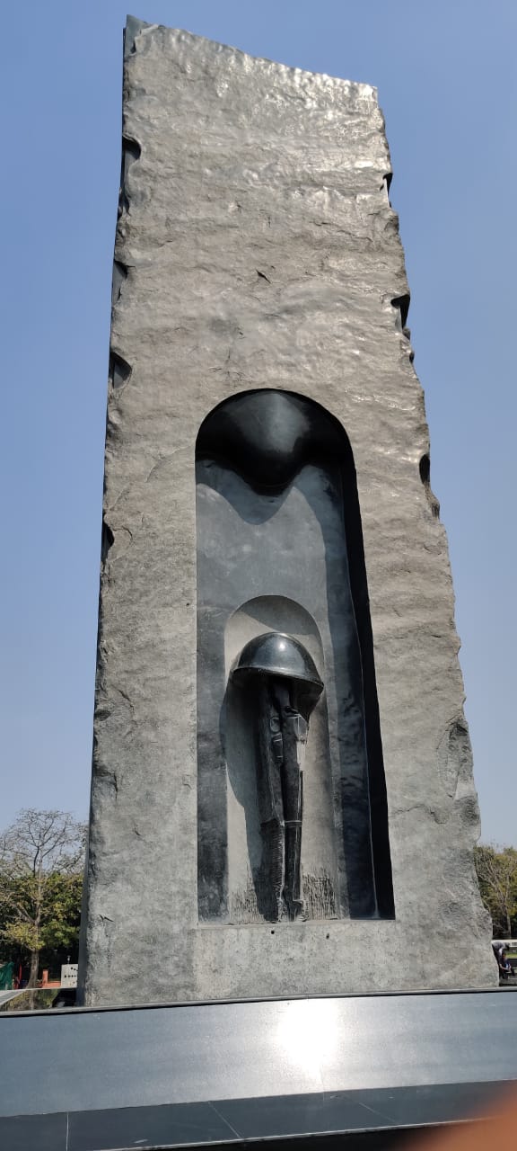
21 Oct every year is observed as Police Commemoration day in honour of 10 Policemen martyred in Hot Springs area of Ladakh by Chinese troops. The Prime Minister of India dedicated the National Police Memorial to the Nation on 21 Oct 2018. The complex is located at Kautilya Marg Chanakyapuri New Delhi. It is spread over an area of 6.12 acres and consists of an impressive 30 foot (9.1 metrea) tall and 238 tonne black granite central sculpture , a museum and Wall of Valour. It commemorates the 34,844 Policemen from all Central and state Police Forces of India who have laid
down their lives.

The entry to the Memorial is free. It is spread over a large area with beautiful ambiance. The newly built underground museum is an excellent place to visit with artifacts ,history, badges, books ,uniforms over the ages and is indeed well maintained. It is a real treat if you visit with children since it is very informative and creatively done. The wall of valour has names of all martyrs inscribed on it.


It is a must visit and a much better place to spend time rather that many other run of the mill tourist attractions in Delhi.


Monday, 4 May 2020

DAY TRIPPING @ UZBEKISTAN-I: THE MONUMENT OF COURAGE, TASHKENT - A SEMINAL SOVIET ERA EDIFICE

The monumental complex ‘Courage’ dedicated to the 1966 earthquake in Tashkent is one of the most significant monuments in Tashkent, the salubrious capital of Uzbekistan.

On 26 April 1966, at 5:24 a.m., an earthquake with a magnitude of 8.3 shook the city. The incredibly strong seismic shaking changed Tashkent"s appearance forever. Half of the city’s inhabitants were left without a roof over their heads and had to live in tents. The earthquake had had its epicentre at a depth of 10 km right under the central blocks of Tashkent, in about the place where the Monument of Courage was erected.


The Earthquake was a seminal moment in the city's history and this memorial draws attention to it in a very appropriate manner. It is visible from the main streets and a brief walk through the area will acquaint you with the earthquake story

Builders from all over the former USSR participated in the reconstruction of Tashkent. Several months after the first new houses were already able to receive the victims of the earthquake. Broad residential quarters sprang up on the outskirts of the capital, while the centre of the city saw its old destroyed buildings reconstructed and renovated.


A black labradorite cube with the date of 26 April 1966 inscribed on one of its sides is installed on a granite pedestal. Another side of the cube presents a clock, the hands of which show the time of 5:24. The cube is split by a crack symbolising the break of the earth and continuing to the foot of the statue,

The statue represents a woman embracing a child and a man trying to protect them with his breast from the strike of the nature. In the background of the monument there is a composition in relief telling about the restoration of Tashkent.

Truly worth a visit – when you travel to Tashkent!

WANDERLUST @ DELHI - V MUTINY MEMORIAL a.k.a AJIT GARH


Delhi Ridge, or simply 'The Ridge', is an extension of the ancient Aravalli Range and runs through the heart of the National Capital Territory (NCR) of Delhi. The Delhi Ridge covers a distance of about 35 km and refereed to as the green lung of Delhi and protects the city from the hot winds of the deserts of Rajasthan. 

It is divided into four zones. North Ridge or Kamala Nehru Ridge is one of the four zones. It is a hilly area near the Delhi University. It was declared a Reserve Forest in 1915. It initially covered an area of 170 hectares but have now shrunk to 87 hectares, making it the smallest of the four ridge zones if Delhi.

The North Ridge, officially known as the Kamala Nehru Ridge, houses an interesting mix of monuments. Scattered along the forested region of the ridge are monuments ranging from the Tughlaq era right up to  the days of the Mutiny.

The monument that stands out among the monuments of the ridge is the towering Mutiny Memorial. It is located at the site of Taylor’s Battery during the siege of Delhi in 1857. It was built in 1863. The Gothic styled red sand stone tapering tower rises from a two tiered platform.

 After the Mutiny of 1857 sites related to the Mutiny were preserved and turned into late Victorian tourist attractions. Monuments were erected all over the sub – continent in memory of the Britishers and Indian soldiers who fought for the British.
The Mutiny Memorial at North Ridge (Kamala Nehru Ridge) Delhi was the most prominent of the mutiny memorials of the sub continent. It holds a special place in the monuments created during the Raj in the sense that the the defence of the ridge by a small contingent of Indian and East India Company soldiers in 1857 against a overwhelmingly superior opponent was militarily a great feat and one of the first successes of the British, which eventually lead to the recapture of Delhi and deposition of the Mughal Emperor.

Built in Gothic style the Mutiny Memorial is a octagonal tapering tower in red sand stone. It has a richly ornamented facade and is crowned with a marble crucifix.

The four tiered tower stands on a two tiered platform and total height of the tower stands at 33 meters. Flights of stairs on all the four sides of the platform lead to the base of the tower. Entry inside the tower is through a gateway on its western wall and a flight of spiral stairways leads to the balconies on the four tiers.

But sadly the gate is kept under lock and key and thus preventing visitors access inside the tower and robbing them of the grand birds eye view of the lush green Kamala Nehru Ridge (North Ridge).
Apart from the gateway to the inside of the tower the other seven sides contain marble plaques embedded inside decorated sandstone archways. Three of them narrates the event in English, Hindi and Urdu. The English plaques says that the Memorial honours the soldiers of Delhi Field Force who died during the Mutiny of 1857.


Among the remaining four plaques one lists the regiments present during the siege of Delhi while the second one lists actions fought at or near Delhi. The remaining two plaques list the KILLED, WOUNDED and MISSING soldiers of the mutiny, which is again sub divide into sub categories like Europeans & Natives and Officers & Non Commissioned Officers.

On 15 August 1972 the Delhi’s Mutiny Memorial was renamed Ajitgarh (Place of the Unvanquished) and a plaque was put at its pedestal. Written in four languages Hindi, Urdu, English

It says that the “enemies” mentioned in the inscription were actually the freedom fighters and martyrs of India, who fought bravely against the repressive colonial rule in the First War of Indian Independence.


The monument which had gone to seed was majorly refurbished prior to the 2010 Commonwealth Games. The compound remains locked to the public but the security guard was kind enough to allow us in for sometime on request. Of course as I have mentioned above- the main building is locked and one cannot access the stairs.

The monument is well worth a visit- if not for anything else, it is unlike you will find of this scale in India- probably the most imposing monument of the Raj (if you exclude the later buildings built in Lutyens Delhi) and for the lovely drive on the lush green North Ridge.

Sunday, 8 March 2020

WANDERLUST @ DELHI-IV: MANGAR BANI- THE SACRED GROVE

A beautiful valley amidst the ancient Aravalli Ranges, Mangar Bani is perhaps the last green patch between a polluted Delhi and a concrete Gurugram, that has been preserved by the local Gujjar community and attracts a lot of birds - indigenous and migratory.

The forest of Mangar Bani is said to be protected by the spirit of a local sage by the name of Gudariya Baba. Legend has it that several centuries ago, a hermit by the name of Gudariya Das Baba came to the village and attained enlightenment in a cave inside this forest. Thereafter, the word spread that curse would befall anyone who fells a tree, uses it to gather kindling or to feed their livestock. Even today, the villagers guard the forest zealously and not a single tree is cut, or even pruned.

Consequently, the forest is now home to leopards, bear, deer, civets and 90 species of butterfly, besides the rare species of birds and peacocks! The beautiful Dhau tree, that once grew wildly in Rajasthan and now is practically extinct, grows with abandon inside Bani. A temple dedicated to Gudariya Das Baba lies nestled in the heart of the forest and serves as a constant reminder to the villagers of the promise made and tradition kept.

There is a small samadhi (memorial) of the saint and also a cave on the hill side where the saint used to meditate.

Friday, 6 March 2020

WANDERLUST @ DELHI-III MALCHA MAHAL: THE MOST MYSERIOUS SITE IN DELHI

Located off Sardar Patel Marg, adjacent to the ISRO earth station on the South Ridge, Malcha Mahal is an old Tughlaq Era hunting lodge and does not boast of any great artitectural or historical significance as such. What it boasts of is a most unbeleivable story of tragedy and surrealism which goes right upto the 21st century- which could probably could happen only in India!
The place reeks for sadness, tragedy and mystery. SInce the last occupant Prince Riaz of Oudh passed away in 2017 after spending over 3 decades of splendid isolation with his mother and sister- the monument has gone back to seed.
It is supposed to be the most haunted site in Delhi and visits after susnset are actually banned by the police. The place is barricaded by Delhi Police and huge cacti which have grown over the years.
To know the unbelievable story of a dispocessed princess and her two princelings and thier life in splendid isolation in the hear of Delhi right upto 2017- you can do some further reading on the link below:-


WANDERLUST @ DELHI-II MADHI MASJID: THE FORTIFIED MOSQUE

Madhi Masjid is a magnificent monument that is prominently located and easy to find, which is why it’s surprising to hear that very few people know about it. Maybe this is because most people do not even realize what it is when they pass by the place as there is no notice board with any name or details given of the monument- a typical malise in many monuments in the country. In fact I did not know what the monument was called when I visited it and had to do quite a bit of reseach on iinternet to figure out the name of the beautiful complex!
The structure is believed to be from the 15th century, which places it in the Lodi Era-early Mughal period. Probably even the authorities are not sure about the exact history of this monument and hence coul dnot find anything about it written onthe site. It’s located just by the side of the Mehrauli Archaeological Park but not exactly within the boundaries of the park.
While it is supposed to be a mosque, it’s a formidable structure built like a fort. It is no longer a functioning mosque and so it mostly remains deserted barring monkeys and pegions. Domes are visible from a distance but as you reach it, you are greeted by an imposing structure in front that is not merely a gate but may as well double up as a watchtower.
As you climb up the stairs and enter through the gateway, you will discover a surprisingly spacious open compound. Even though the details are painfully lacking, it can be assumed that there was a wall mosque and also a normal mosque inside it. It was intricately decorated at one point of time, as suggested by the now-worn but still visible bluish tinged tiles on the walls and the dome. There are stairs that go down to the inner chambers but they are practically closed nowadays. If you look closely, you will find interesting Indo-Saracenic sculptures adorning the walls and pillars in the entire compound.
Considering its vintage- the monument is pretty well preserved.


WANDERLUST @ DELHI-I THE JAMALI KAMALI MOSQUE

Right next to the iconic Qutub Minar is another Archaeological site that very few people know about. People who do know about it just know that it is another one of several Mughal Era monuments standing in ruins all over Delhi. This is the Jamali Kamali mosque which if one is to consider has more glory to it than Qutub Minar itself but the only attention it now gets is because of the haunting stories related to djinns that are believed to reside there (beleive still some sufi faquirs carry out an exorcism on every thrusday to summon the djinns!)

This mosque, built in 1528-29, is located within Mehrauli Archaeological Park, which actually shares boundary with Qutub Minar premises. Entrance to this park is however about 500 meters away from Qutub Minar’s entrance gate. Within the mosque, built in a separate area, are the tombs of Jamali and Kamali.

After his death in 1535, Jamali was buried in his tomb alongside Kamali. Jamali belonged to a merchant family and was a very popular poet known for his famous works such as ‘The Mirror of Meanings’, ‘The Sun and Moon’ and ‘The Spiritual Journey of the Mystics’ etc. According to legend, it’s said that both these men - Jamali and Kamali, were deeply in love with each other. If interested, you can read the book ‘Jamali-Kamali, A Tale of Passion in Mughal India’ by Karen Chase who has described her personal take on their story in a beautiful manner.

Red sandstone and marble design (a popular trend in Mughal architecture) have been used at the mosque. Five arches are carved out in the prayer hall where a dome rises from the top of the central arch. Painted in red and blue, the Jamali Kamali tomb stands as a square structure with a flat roof over it. Quranic inscriptions and coloured paintings add to the beauty of it.
Large courtyards around both these structures give you a number of angles for clicking nice pictures. The garden near the tomb, with its spruce trees and lush greenery, serves as a good relaxing spot. The view from the boundary wall of the tomb offers you a sight of the magnificent Qutub Minar. At the archaeological park, a stroll down the undulating curves of the green landscape is nothing less than refreshing!


Sunday, 17 June 2018

A RUINED TEMPLE AND AN ANCIENT MYSTERY


When you travel from Bhuj towards Mata No Madh, the most famous shrine of the patron Goddess of Kutch- Ashapura Mata, you cannot but miss an ancient ruined temple on your left when you reach Manjal a village about 30 km down the highway from Bhuj.

During one of our trips, we finally decided to stop and explore the place. To our surprise, the temple- known as Punvareshwar Mahadev Temple was one of the oldest structures in Kutch and carried along with it an ancient legend. The general area of the temple is known as Paddhargadh or Punvaranogadh and has a few other ruins of fort and temples and is associated with the ancient legend of Jakh Bothera.

The ‘Jakhs’ were said to have been shipwrecked on the Kutch coast and came ashore at place, now known as Jakhau. Variously described as tall and fair-complexioned with an advanced culture, their traditional number is seventy-two with at least one woman. Their origins are obscure.
Later they were revered by people of Kutch as folk dieties and temples are erected in their dedication at a number of places in Kutch. A fair dedicated to them is organised on the second Monday of Bhadrapad (September-October) every year on the foothills. This fair lasting two to three days is attended by thousands of pilgrims.

Front View of the Temple
The temple itself was built around 878 AD by Punvara, son of the chief of Kera, Kutch. Quarreling with his family, Punvara, whose chief characteristic seems to have been cruelty, resolved to found a city and call it after his own name.

When the city was finished, the architect was rewarded by having both his hands chopped off that he might not do work like it for anyone else. It is said that Punvara married a daughter of the king of Sindh. She was devotee of Shiva and carried the deity to Punvaranogadh where she installed it.

Main Deity of the Temple
Soon after, seven devotees of Jakhs renowned for their virtues and miracles settled on a hill near Punvaranogadh. Hearing of their fame, Punvar's childless queen had an underground she after six months prayed them to ask the god to give her a son. But, for her husband's sins, until a sacrifice was offered in the palace, the prayer could not be granted. By the underground passage the holy men entered the palace and were performing their rites when Punvara,hearing that there were strange men in the women’s’ rooms, forced his way in, seized the devotees, and set them with bare feet to tread out corn in a threshing floor bristling with harrow-spikes.

Pitying their sufferings a friendly barber named Babra offered to take the place of one of them. The freed devotee went to the top of Lakhadiya hill nearby and call Jakhs to their aid. Jakhs heard the prayer, and, with an earthquake that shook the hills, appeared with seventy-one brothers and a sister, Sayari or Sairi.

Called on to give up the holy men, Punvara refused and with the help of a magic amulet suffered nothing from the arrows of Jakhs. Then Sayari, taking the form of a mosquito, bit Punvara on the arm so that he drew off his amulet, leaving him vulnerable. A stone falling from the roof broke his head. Jakhs cursed the town and it has since lain desolate.

Punvareshwar temple is a synthesis of two styles. This Shiva temple, which combines elements of the Dravida and Nagara styles, is probably the oldest of its kind in Kutch. Built on a high plinth and sparsely ornamented, the temple itself is relatively small in size. But it has all the essential elements including an enclosed ambulatory around the sanctum. Parts of it appear to have been rebuilt using the original material.

Ruins of Ancient Carvings
In the centre of a platform, 7 feet 9 inches high 160 feet long and 41 wide, stands a temple of Shiva, 50 feet 9 inches long and 22 feet 3 inches wide. In each corner of the platform is a small ruined shrine. Between the ruined entrance and the porch is a hollow for sacrificial fire, agnikund. The temple, facing the west, of blocks of grey and black iron sandstone put together without cement, must have stood about fifty feet high. The porch, 261⁄2 feet long and 18 wide, has 16 pilasters and 8 square, 12 feet high, pillars forming two aisles. In the brackets are figures of men and lions. The dome has fallen, hut an upper floor, with rosettes in the middle of the ceiling and a cornice of creeping plants cut in the stone, is entire. Above the lintel are large figures of musicians. The upper part of the shrine has fallen and been rebuilt. Near the temple are some tombstones apparently of later date, but without any writing.

This temple, though ravaged and badly damaged by frequent earthquakes surely begets a visit when you travel to Kutch next- if not for anything else but for its antiquity and the quaint legend surrounding it. 

Sunday, 22 January 2017

ASHAPURA MATA TEKRI : A BIRDS’S EYE VIEW


Kutch is an ancient island separated from mainland India and rest of Gujarat by the Rann of Kutch, a salty waste which is inundated by sea water for more than half the year. Owing to this Kutch has developed a unique culture and distinct traditions. Even the Kutchi dialect has shades of Sindhi and other languages over and above the mother language Gujarati.

The region was ruled for a long time by the Chandravanshi Rajput Jadeja clan. The revered mother Goddess of Kutch is Ashapura Mata, a form of Shakti and her prime seat is at Mata Na Madh located about 90 km West of Bhuj. Well, here we are not talking about Mata Na Madh, about which we’ll talk some other time but a lesser known temple for the same Goddess located atop a mountain, keeping in spirit of this blog of being off beat and less touristy.

Ashapura Mata has numerous temples located all over Kutch, but the temple we talk about here is unique in the sense that it is located on an imposing hillock over 1026 feet in height, jutting out from the plains and located just off NH 341 between Anjar and Bhuj near the Village of Kukma.

Signpost on NH 341 marking the turning
As I travel frequently from Anjar and Bhuj, the hill dominating the horizon towards the West between the villages of Ratnal and Kukma always mystified me. Finally, one day I decided to make an impromptu visit and explore the hill.


Cabbage Fields Enroute
To my surprise, there was a prominent sign on the highway showing the way to the Ashapura hill shrine. It is only then I realized that the structure seen from a distance was actually a temple.

The hillock is accessible through a dirt track which though narrow is well marked and cuts across quaint cauliflower and mustard fields. The track winds for about 3 km from the highway and you reach a clearing at the base of the hill. The base too has a temple and a small house where the priest and his family live.

Steep Steps leading to the Top
 The hill itself is very imposing and forms the massif of a small range which stretches from the South the North. The hill top is accessible through a steep yet well maintained flight of steps (519 badly designed steps in all), a trekker’s trail or a newly cut gypsum covered kuccha road leading to the top.

As I had a very capable Tata Xenon 4-wheel drive SUV, I decided to try the gypsum road leading to the top. The 1 ½ km or so of the climb is treacherous to say the least. The SUV in 4 wheel drive –low mode to had its hands full  pulling through the fine gypsum covering the track as the track was very slippery and had impossible gradients and rock falls at places. My co-passengers surly had some jitters but we made it very safely to the top.

Breathtaking View from the Summit


Goddess Ashapura
The Temple on Top


The top of the hill is actually quite small and houses a small well maintained temple. There is nothing historical about the architecture of the temple and it has been done up in concrete and tiles. However, the idol of the Goddess definitely  looked pretty ancient. The priest informed us that the idol was about 500 years old, but any specific history was unknown. The hillock itself is composed of ancient volcanic basalt and the spurs are composed of layers rock covered with cacti and other wild foliage. The priest also told us that a lot of wildlife existed in the scrub forest surrounding the range especially, nilgai, foxes, wild boar and an occasional leopard.

View of the Range from the Top
The view of the surroundings from the hill top was absolutely breathtaking to say the least. I believe on a clear day one could see as far as Bhuj and also the sea. But even on the day we visited (there was a bit of a haze) the view really was awesome, the hillock being the highest feature for many miles around. It was also very windy at the top.

We decided to take the steps while coming down. The steps are very well maintained with railings on both sides. But on the flip side, are badly designed with some steps  being almost ½ a metre tall. Therefore one has to be a little careful while walking down.

A visit to Ashapura Mata Tekri, Kukma is definitely worth it for its unspoilt and uncrowded ambiance, nice trek uphill, a breathtaking view and of course the blessings of Maa Ashapura- the guardian of Kutch!  

Coordinates:- https://goo.gl/maps/jXgk2TFDgco

Monday, 16 January 2017

THE LIMESTONE CAVES OF TAPKESHWARI

A 500 year old temple with not one but three perennial springs, surrounded on 3 sides by low hills and the hills dotted by some fantastically patterned limestone caves and all this not even properly sign posted, let alone figuring in some tourist glossy. This is Tapkeshwari located very close to the City of Bhuj in Kutch.
Panoramic View of the area around
Quietly tucked away in the wilderness just behind the Bhuj Cantonment is the Tapkeshwari Temple. The temple is situated at the end of Tapkeshwari Road, which originates at the south side of Bhuj Town. To the West of the road is the small village of Haripar, and to the East is a compound of a BSF Unit. 
The Temple Complex

Unfortunately like a lot places in India, apart from the old idol, nothing much remains of the original shrine which has been replaced by an abomination of concrete and glazed tile structure. Luckily old structures with a lot of character still hug the hill sides.

The temple complex is located in the centre of a horse shoe shaped hill. An old lady who is also the pujarin of the temple told me that the shrine is over 500 years old. The name of the temple comes from the Gujarati word "tapakvu," which means "to drip". 

The main Aquifer below the Temple
Legend states that this used to be the site of a year-round spring which used to cause water to "drip" down the cliff walls (though we could not find any water as such dripping down from the hill side). As per the old lady, the Goddess dug her mighty trident into the ground which resulted in the three perennial springs located in the complex. The largest aquifer is located right below the temple, the smallest at the entrance and the third closer to the hill side to the North.    

Old Structures along the Hill side
Apart from the temple, the fantastic limestone caves overlooking the complex are worth a visit. They are accessible by stairs on the north side of the temple and then a scramble up a rough trail to the top of the overlying ridge. The caves are breathtaking and seem to have been eroded millions of years ago by water (probably when the whole region was sea bed). Unfortunately, they have been vandalized at a number of places by louts scribbling their names and other gibberish at a number of places. Still they are fantastically patterned and offer a beautiful view of Bhuj City from the top.

 A day’s visit is definitely worth it considering that the place is located very close to town, has some historical value and above all one can visit some beautiful limestone caves and have a great view. Just a word of caution is to look out for honeycombs when visiting the caves- there are quite a few of them in the higher reaches. 


Fantastic Patterns
Caves to the South
Treacherous Steps 
Dramatic View


Coordinates:- https://goo.gl/maps/s2iB7kfwF4L2